
| |
| Volume 6, Number 6 | November/December 2000 |
This past June I had the privilege of exploring Mount Yeroham, the Biblical Mount Sinai.[1] Last issue I shared results from my investigation of the bamah (high place) built by Moses at the foot of the mountain four and a half thousand years ago,[2] and my visit to the archaeological remains of stone dwellings Moses' Midianite in-laws built on another hill at the foot of Mount Yeroham.[3]
My investigation of Yeroham was put on hold for a week while I attended the 17th International Radiocarbon Conference near Jerusalem, listening to scientists from around the world presenting results of their research, and presenting a paper myself on new radiocarbon dates on the Cave of the Treasure mat obtained as one of the research efforts of The Biblical Chronologist.[4]
The present article resumes the narrative back at Yeroham after the conference. It's purpose, as with the previous article, is to document the state of Yeroham/Sinai today, and to put on public record what I found there.
The final sessions of the 17th International Radiocarbon Conference had ended by noon on Friday, June 23. After lunch my cameraman, Philip, and I began the several hour drive from Jerusalem back to Yeroham. When we were situated in our lodging at the Ben Gurian University of the Negev once again I began to plan our next day's hike.
My goal this time was not the archaeological remains at the foot of Mount Yeroham/Sinai—i.e., the bamah and the Midianite/Kenite settlement—but rather the mountain itself. I was especially keen to visit the summit. The Bible records that "the Lord came down on Mount Sinai, to the top of the mountain; and the Lord called Moses to the top of the mountain, and Moses went up".[5] I wanted to see this place where Moses had met with God.
 |
 |
 |
 |
 |
 |
 |
I suppose there are many reasons why someone might wish to visit the summit of Sinai. My reason was probably somewhat unusual. I was interested in the possibility Sinai presents of finding some answers to some difficult scientific and theological questions. The natural and the supernatural intersected at Sinai in an unusual way four and a half thousand years ago. We are unable to study supernatural processes directly in the science laboratory because they are intrinsically nonreproducible. As a result our ignorance of them is profound. Sinai offers a rare opportunity to study the intersection of the natural and the supernatural—to probe the aftermath of a miracle within the physical creation. The Bible records, for example, that "the mountain burned with fire to the very heart of the heavens".[6] Would we find evidence of this burning at the summit? And if we did, would the evidence be explainable in terms of some natural phenomenon, or would we find an effect (i.e., evidence of highly elevated temperatures) with no apparent natural cause?
Many of the phenomena associated with God's presence on Mount Sinai seem to coincide with what one might naturally expect of a volcano. The "consuming fire on the mountain top", the "thunder and lightning flashes and thick cloud upon the mountain", the "very loud trumpet sound" (this can result from pressurized gases escaping from the earth through a narrow vent), the "smoke" which "ascended like the smoke of a furnace", and the earthquake ("the whole mountain quaked violently") are all readily associated with volcanic eruptions.[7] This leads to the question: "Did God use a 'natural' volcanic event as the backdrop to His visit on Sinai?" Which leads to the further question: "Is Mount Sinai a volcanic mountain?"
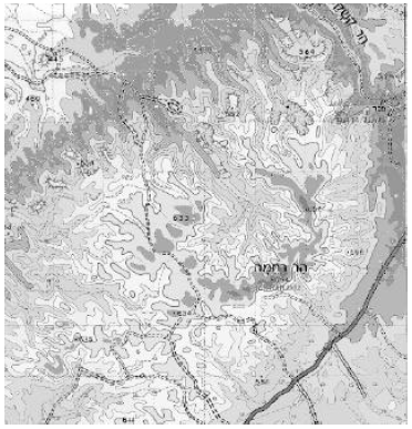 |
As part of my preparations for the trip to Yeroham/Sinai I had scanned a topographical map into my computer, and then colored in the various contour elevations. I was surprised to find a clear crater-like shape emerge from this exercise (Figure 8). The present-day summit of Sinai is part of the "rim" of this "crater".
 |
 |
 |
 |
 |
 |
This obviously lent some support to the idea that Yeroham/Sinai might be of volcanic origin. But it was far from a guarantee. Crater-like features can result in other ways. And also on the other side of the ledger we should note that Exodus 19:18 is not very supportive of the idea that Mount Sinai was naturally volcanic. It says [NASB, my emphasis]: "Now Mount Sinai was all in smoke because the Lord descended upon it in fire". This seems to stipulate that God's presence was the direct cause of these volcanic-like phenomena at Sinai.
We obviously needed to go look at the crater to learn what we could of its origin—to see what story its rocks might tell. Our effort would be amateur only—I am a chronologist, not a geologist, and Philip is not a geologist either. But there is much that even amateurs may learn in the field, and we hoped to record much of what we saw on video for professional appraisal at a later date.
 |
Having visited Yeroham briefly before the radiocarbon conference I knew that the mountain was predominantly limestone. Limestone is a sedimentary rock, not an igneous rock. This led to the question, "What sort of volcano does one get in limestone?"
Fortunately, I was able to talk to a professional geologist, J.F. Shroder, Jr. of the University of Nebraska at Omaha, about this during the week of the radiocarbon conference. He said that yes, one can get volcanoes through limestone strata and that such volcanoes can produce a very fast flowing lava. When I showed him my colored topographical map he said that the crater shape might be indicative of volcanic activity or it might be just an erosional feature. When I asked him what we should look for at the mountain to try to tell for sure whether this crater was due to volcanism or erosion he said we should look for evidence that the limestone strata around the crater had been blistered upward from the pressure of magma forcing its way to the surface. This was all very helpful.
Exploration of the crater and its strata would require about a ten mile hike in, and another ten mile hike back. Since we planned to photograph everything as we hiked, we would not be moving along very quickly. We were obviously in for a full day.
 |
 |
 |
 |
 |
 |
 |
We knew from our previous hike to the bamah and the Midianite settlement that the exertion of climbing up and down steep ravines beneath the desert sun was a reality to be taken seriously. We would take four quarts of water each. Water is heavy to carry up and down desert mountains; one would like to have along a little extra, but not too much. We figured four quarts would be about right with modest rationing. We also took along a small supply of granola bars, raisins, and pretzels. We didn't plan on eating much until we got back out since food consumption increases the need for water. We planned to watch the time closely and begin the hike back out at noon, even if we had not accomplished all of our goals, to make sure we got back out before dark.
We rose just after 4:00 a.m. the next morning. By 5:30 a.m. we had parked our car and begun our hike toward the mountain. The early morning air was full of humidity, and there was an unexpected cloud cover.
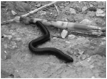
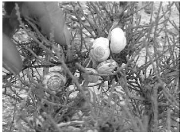
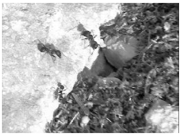
By 6:10 a.m. we were in the ravine between the bamah and the Midianite settlement hills. The heat and humidity were making hiking a sweaty affair. We took a short break to watch the desert critter shown in Figure 2 mosey its way along the desert floor, and to photograph the snails shown in Figure 3.
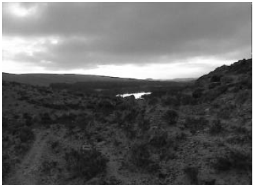
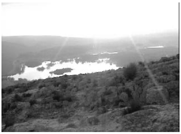
Looking back down the wadi we could see the sunrise reflected in the reservoir (Figure 4).
By 6:30 we had attained the bamah. We didn't linger there. The cloud cover was beginning to break up and the intermittent full sun was already hot. We pressed on toward the summit.
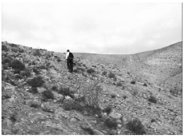
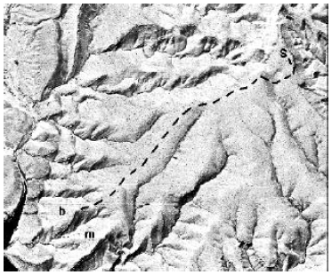
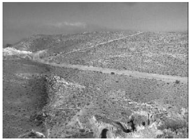
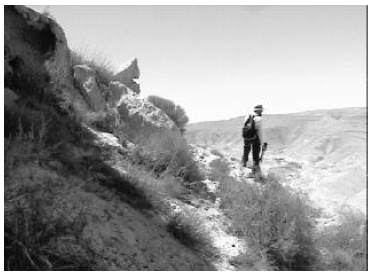
We followed the gentle slope of the mountain from the bamah up toward the summit along an arm of the mountain (Figure 13). The wadi ravines provided natural boundaries on either side of our path.
The walk to the summit from the bamah was leisurely and pleasant. It contrasted with the climb to the bamah from the plain, which is short and steep. It was easy to see how Moses could make this climb to the summit repeatedly as he did, at age eighty, without suffering heart failure in the process.
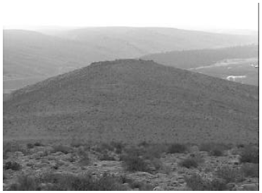
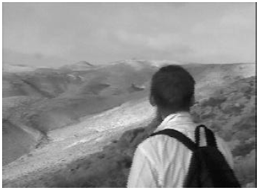
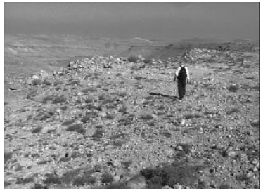
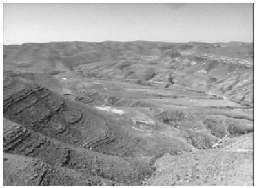
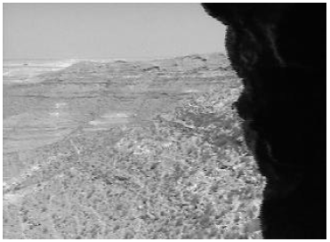
We were treated to scenic, panoramic views as we walked, especially back toward the plain to the southeast (Figure 10). The sun was often behind a haze, greatly increasing our comfort.
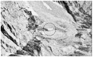
Eventually we came to the end of the arm of the mountain we had been following. A broad shallow ravine was all that separated us from the summit. As we looked across the ravine we were surprised to see several military roads cut into the side of the mountain only a few hundred feet down from the summit (Figure 17). I had thought that the summit would seldom if ever have been visited since Moses' time. The sight of these bulldozed dirt roads exploded that mistaken notion and dashed my hopes of a well-preserved summit.
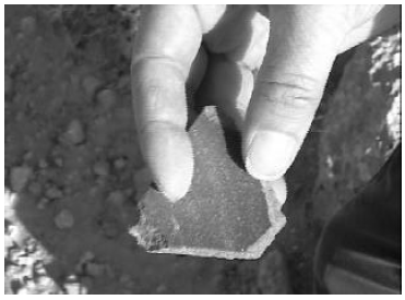
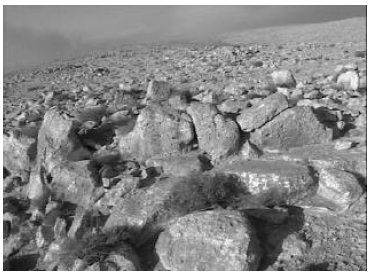
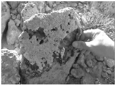
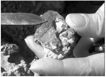
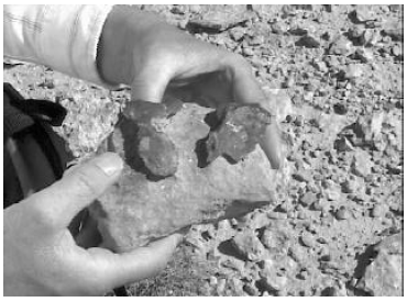
We crossed the ravine and, after we had climbed to the top on the other side, found ourselves at the edge of the crater, still somewhat below the summit. The rim of the crater at this location, just a short distance to the north of the summit, was strewn with rounded, pitted, limestone rocks and boulders. Many of these wore a broken veneer of some other sort of brownish rock, which gave no limestone reaction when tested with hydrochloric acid. We had not seen this sort of veneer anywhere else. It was mainly on the side of the rocks facing the crater—it looked like it might have been spattered onto them from the direction of the crater. We spent a lot of time photographing and studying these rocks, trying to understand what this veneer meant. But we were unable to reach any definite conclusion that day, and I am still uncertain what, if anything, the veneer may have to do with the volcanic-like phenomena which accompanied God's descent on Sinai.
 |
 |
 |
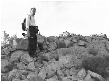
We reached the summit at 8:15 a.m. We found that the military had indeed been there before us. The rocks had obviously been moved around significantly, and there were remnants of wire running across the ground. All remaining hopes of viewing the summit as Moses had left it were dashed at this point.
In hindsight it is clear that the use of this area as a military training ground guaranteed that the summit would be significantly disturbed. The combat advantage offered by even just the clear view in all directions was sufficient to ensure this.
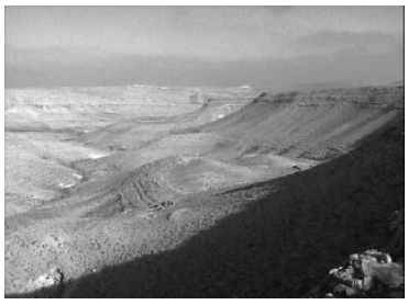
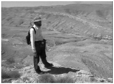
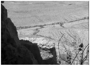
The air was comfortably cool, with a kindly breeze blowing. The view was very nice, especially to the east. For some reason we failed to photograph this. The view to the west looked out over numerous sandy-white hills running down into the crater (Figure 20). To the northwest the view plunged steeply down the inside crater wall at our feet and across its depths to the breakout in the north wall where the wadi which drained the crater transected the rim. We took some time to check our bearings against our map, using a pocket compass, and confirmed that we were, indeed, at the summit of Mount Yeroham.
We snacked a little on pretzels and discussed the next leg of our hike. Our next objective was to view the strata on the west side of the breakout from its east side. Our purpose was to try to determine whether the limestone strata gave any indication of having been blistered upward, as we had been advised by our geologist friend. This would take us northward, along the east rim.
We encountered more partially veneered limestone as we started out along the rim. If one imagined the veneer being splattered onto the limestone rocks through the air, then its source seemed to be back in the general direction of the summit. As we continued to walk along the rim away from the summit the veneer gave out and was eventually no longer seen.
We also encountered large areas strewn with chert flakes, not too far north from the summit, as if at some point in the past someone had spent a lot of time working flint tools in the area. These flakes possibly predate even Moses' ancient presence on the mountain.
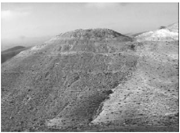
We reached the east wall of the breakout around 10:45 a.m. The strata on the west wall sloped gently upward toward the south (Figure 25), and thus toward the crater, but this seemed to be a general feature of the entire region rather than due to any local blistering. Overall, the strata which were visible from the rim of the crater did not appear to support the idea of blistering, and thus did not seem to support a volcanic origin for the crater.
 |
 |
 |
Our next objective was to descend the crater wall into the bottom of the crater itself. We wanted to learn what types of rock would be found at the bottom. We would be looking especially for any igneous rocks in this otherwise clearly sedimentary geological landscape. After a short rest, we began the steep descent.
 |
 |
 |
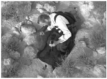
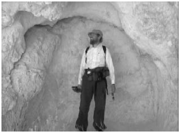
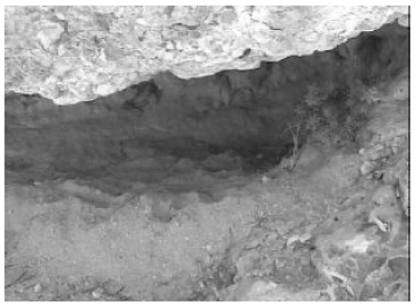
We hadn't gone very far, however, before we noticed a group of shallow caves below the rim only a few hundred feet from where we had been standing. We had seen many such caves at a distance in the various ravines of the mountain. We were interested in them because of the Biblical record of Elijah's flight from Jezebel.[8] From that record we learn that Elijah fled to Horeb (i.e., Sinai) where he stayed for a time in a cave.
When I had been preparing to travel to Mount Yeroham I had wondered whether I might be able to identify the cave in which Elijah had stayed. It had become clear, from our earliest closeup encounter with the mountain, that there were plenty of caves to choose from—too many, in fact, to allow an easy identification of which one Elijah might have used.
But this was obviously a good opportunity to take a close look at a few of these caves to get a feel for how suitable they might have been to Elijah's purpose.
Though they varied much in size, all were fairly shallow—they did not extend back into the mountain any great depth. They appeared to have resulted from large blocks of limestone breaking out of the steep face of the crater wall or from rapid erosion of soft spots in the limestone. It was easy to see how they could function as comfortable shelters in time of need. Judging from droppings on the floor, some of them were presently in use by local desert wildlife for just that purpose.
 |
We were well into the final hour before noon by the time we had finished exploring and photographing the caves. Other than the splotchy veneer on the rocks near the summit everything we had seen to this point seemed to support only a sedimentary origin for the rocks of this mountain—we had seen nothing in obvious support of any volcanic activity at any time in the past. I was eager to get to the bottom of the crater to see what additional light might be shed on all of this. It would only take a single basaltic rock in the washout gravels of the wadi which cut its way across the crater floor to begin to turn the tables.
I surveyed the crater wall beneath the caves for the best way down. Some routes were obviously too steep. Having picked what seemed to be the best alternative, I started to zig-zag down through the loose limestone debris, leaning into the crater wall as I went. ◇
 |
I am disappointed to have to report that no new satellite photos have been obtained from Space Imaging, the commercial satellite company, since last issue. As it is now well past the time of year when reasonably snow-free coverage can be obtained in the Mount Cilo region, the earliest we can now hope for obtaining modern satellite images of IO3 is late next summer.
The reason given for Space Imaging's failure to obtain the images this past summer/fall is the huge consumer demand for this new technology which has sprung up since the commercial satellite came into service last year. (Supply and demand has driven the cost of new orders up by a factor of three compared to the cost when we placed our order.) The Biblical Chronologist order is not a routine one, being more demanding of camera positioning, time of image capture, and other factors than most orders. In addition, it is a small order compared to many others (though not small to us!). As a result, it does not appear to have had as high priority at Space Imaging as we might have wished. We are hoping that things may have calmed down in this industry sufficiently by next summer to yield a more satisfactory result.
I would like to extend a special word of thanks this issue to Basil Finnegan for the many hours he has spent of his own time on this modern satellite images project. Basil is a member of the ark search project team. He is The Biblical Chronologist interface to the commercial satellite world. When we get the images we are after it will be largely due to Basil's patient, persistent efforts. ◇
The Biblical Chronologist is a bimonthly subscription newsletter about Biblical chronology. It is written and edited by Gerald E. Aardsma, a Ph.D. scientist (nuclear physics) with special background in radioisotopic dating methods such as radiocarbon. The Biblical Chronologist has a threefold purpose: to encourage, enrich, and strengthen the faith of conservative Christians through instruction in Biblical chronology, to foster informed, up-to-date, scholarly research in this vital field within the conservative Christian community, and to communicate current developments and discoveries in Biblical chronology in an easily understood manner. An introductory packet containing three sample issues and a subscription order form is available for $9.95 US regardless of destination address. Send check or money order in US funds and request the "Intro Pack." The Biblical Chronologist (ISSN 1081-762X) is published six times a year by Aardsma Research & Publishing, 412 N Mulberry, Loda, IL 60948-9651. Copyright © 2000 by Aardsma Research & Publishing. Photocopying or reproduction strictly prohibited without written permission from the publisher.
|
^ Gerald E. Aardsma, "Yeroham: the True Mount Sinai" The Biblical Chronologist 6.4 (July/August 2000): 1–11.
^ Gerald E. Aardsma, "The Bamah of Moses at Mount Sinai" The Biblical Chronologist 6.3 (May/June 2000): 1–10.
^ Gerald E. Aardsma, "Report on the Excursion to Mt. Yeroham – Part I" The Biblical Chronologist 6.5 (September/October 2000): 1–13.
^ Gerald E. Aardsma, "Radiocarbon Dating Noah's Flood – Part II" The Biblical Chronologist 6.2 (March/April 2000): 1–11.
^ Exodus 19:20, NASB.
^ Deuteronomy 4:11, NASB.
^ Exodus 19:16–19; 24:16–17, NASB.
^ 1 Kings 19:1–13.